


Military History | Housesteads Vicus — Six Kept, the Rest Traced
· 1931
Unreviewed contributionBy kevin · · Report an issue
















































Find memories left by people near you.
Distribute Bounty
This will distribute the bounty equally among all qualifying memories. This action cannot be undone.
Cancel Bounty
Are you sure you want to cancel this bounty? The remaining amount will be refunded to your account.
Success!
Operation completed successfully.
Error
Something went wrong.


Military History | Housesteads Vicus — Six Kept, the Rest Traced
kevin
In 1931 the digging at Housesteads moved outside the walls. Over the seasons that followed, the Durham University Excavation Committee worked not on the fort but on the vicus, the civil settlement outside its south gate. English Heritage calls it "the earliest extensive investigation of such a settlement".
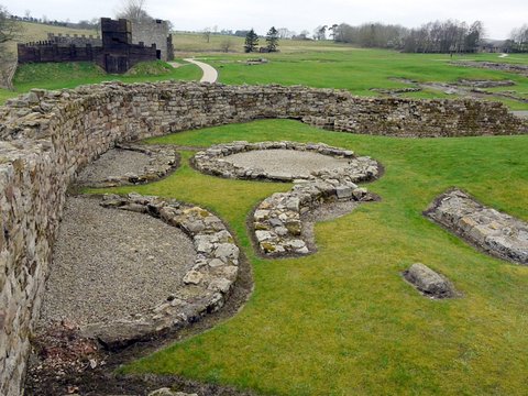
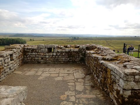
How many buildings there were is not settled. The Northumberland Historic Environment Record says 26, English Heritage 27, Historic England's scheduling text "over 20". Six were fully excavated and consolidated, and those six are what stands south of the gate today: low courses of grey stone that Historic England describes as "believed to be the foundations of a group of shops and/or taverns".
The rest were traced. The National Trust's record quotes the excavators' own phrase for the method, "a rapid tracing of the walls", and gives its verdict on two of the six it names, I and II: "little archaeological potential survives". On the published plan two more, XIV and XV, are transposed.
Even the campaign's end is disputed. The modern records give 1931 to 1934. Eric Birley, who directed it, wrote in 1952 that the work ran from 1931 to 1936, "for the most part in the civil settlement outside the fort".
What nobody dug is what kept its evidence. Beneath the north slope of Chapel Hill, where R. E. Birley's excavation of 1960 and 1961 found five buildings clustered together, the ground held a wooden coffin, a wooden coal bunker, wattle screens and shoes; the Historic Environment Record calls those deposits exceptionally well preserved. East of the fort, another quarter of the settlement has never been excavated at all.
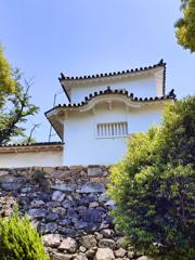
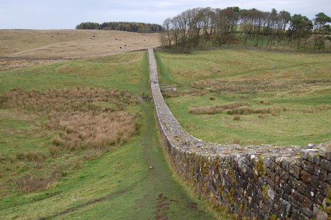
📸 Cover: the consolidated vicus buildings south of the fort, looking north-west toward the fort's south wall; photograph by Sandy Gerrard, 5 September 2021, CC BY-SA 2.0 via Geograph Britain and Ireland and Wikimedia Commons. Second image, the same buildings looking south away from the fort, with a threshold slab in the foreground; by Mike Peel, 18 May 2014, CC BY-SA 4.0.

changes?
delete this memory?
We detected that you have a Blox in your crypto wallet! We will import the Blox into your account.
Click on done below to complete the import.
Welcome Back!
Sign in to preserve cherished moments
Don't have an account?
Welcome!!
Sign up and start preserving cherished moments
?
?



Choose your payment method
Buy with Metablox Credit
Do you want to mint Blox with Metablox Credit?
Which Crypto would you like to use?
Purchase Confirmed!
Your Blox is being minted on-chain and will appear in your profile shortly.
Log in or sign up to claim your Blox.
How many credits do you want to buy?
$100 USD = 1 Metablox Credit = 1 Blox.
Use Metablox Credit to mint any Blox you want on the map.
 expand_more