


Military History | Housesteads South Gate — The Bastle They Measured but Could Not Date
· 1986
Unreviewed contributionBy kevin · · Report an issue










































Find memories left by people near you.
Distribute Bounty
This will distribute the bounty equally among all qualifying memories. This action cannot be undone.
Cancel Bounty
Are you sure you want to cancel this bounty? The remaining amount will be refunded to your account.
Success!
Operation completed successfully.
Error
Something went wrong.


Military History | Housesteads South Gate — The Bastle They Measured but Could Not Date
kevin
In 1986 a turf-covered retaining wall up to 2.2 metres wide came off the east side of a small stone building at the south gate of Housesteads, and A. M. Whitworth drew the stonework before the consolidation went in. Most of what can be said about it comes from that record.
It is a bastle: a fortified farmhouse of the Anglo-Scottish border, cattle housed below, the family above. It was built out of the fort it leans against — walls of re-used Roman squared stone, and a Roman guard chamber annexed whole as a second room, its original doorway blocked and a new one cut through.
P. F. Ryder's 1990 survey gives a sub-rectangular building about 8.5 by 7 metres, walls 1.1 metres thick standing about 1.5 metres. The Northumberland Historic Environment Record gives walls up to 1.2 metres thick surviving 1.2 to 2.6 metres high, a flagged floor in the main room, splayed vents in the south, east and west walls, chamfered jambs on the doorway and a socket each side for a locking bar.
John Collingwood Bruce got there first and went no further. Writing in 1867, after the gateway had been laid bare, he could distinguish the byre, the kiln and the steps, concluding that "some borderer, probably of the moss-trooping period, had appropriated the eastern part of this gateway to his own purposes". He named nobody.
Nobody since has either. The sixteenth-century date comes from its type, not from anything found here; the National Trust files it not as a date but as a band, 1550 to 1650. On the builder the Historic Environment Record hedges three ways: the Armstrong family, or perhaps a landowner such as Nicholas Crane or Hugh Crowhall. Even the end is dated by an absence: the record reads it as derelict by the early eighteenth century because it is missing from Stukeley's sketch.
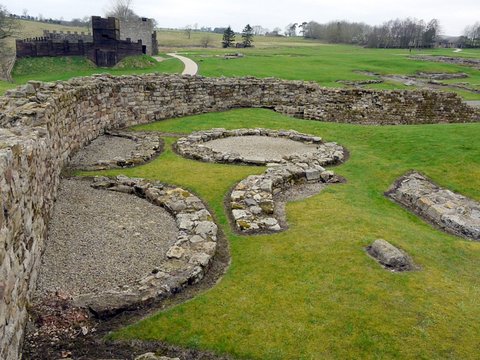
It stands today at the south gate, roofless: two rooms of Roman stone, a drying kiln the Ministry of Works took apart and rebuilt in 1956, and a stair of eight steps that stops in the air.
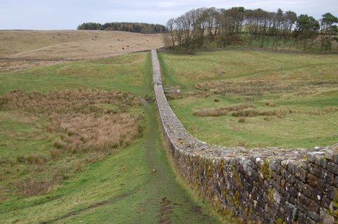
📸 Cover: the remains of the south gate of Housesteads, looking south from inside the gateway; an area view of the gate structure the bastle was built onto, not the bastle identified separately. Photograph by Rudi Winter, 5 August 2018, CC BY-SA 2.0 via Geograph Britain and Ireland and Wikimedia Commons. Second image, the south gate from the south with its signed marker and the central pier of the twin portal; by Steven Fruitsmaak, 27 October 2007, public domain.



changes?
delete this memory?
We detected that you have a Blox in your crypto wallet! We will import the Blox into your account.
Click on done below to complete the import.
Welcome Back!
Sign in to preserve cherished moments
Don't have an account?
Welcome!!
Sign up and start preserving cherished moments
?
?

Choose your payment method
Buy with Metablox Credit
Do you want to mint Blox with Metablox Credit?
Which Crypto would you like to use?
Purchase Confirmed!
Your Blox is being minted on-chain and will appear in your profile shortly.
Log in or sign up to claim your Blox.
How many credits do you want to buy?
$100 USD = 1 Metablox Credit = 1 Blox.
Use Metablox Credit to mint any Blox you want on the map.
 expand_more